Geolocate

Myrtle Grove topographic map

Click on the map to display elevation.

About this map

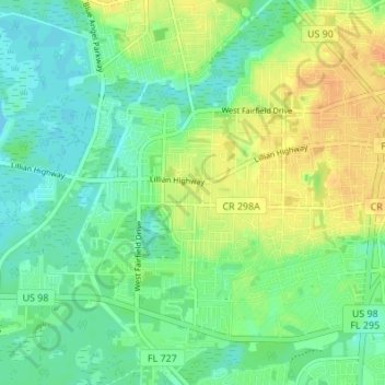
Name: Myrtle Grove topographic map, elevation, terrain.

Location: Myrtle Grove, Escambia County, Florida, United States (30.38975 -87.32739 30.44845 -87.27604)

Average elevation: 13 m

Minimum elevation: -1 m

Maximum elevation: 32 m

Gear up for your next adventure:

🛶Kayaking & Water Sports Gear - Equip for water adventures
🔋Rechargeable Batteries - Eco-friendly power for headlamps and GPS units
🍁Eco‑Friendly Outdoor Products - Sustainable outdoor gear
🗾Ireland Map Books - Top map books for exploring Ireland
🏕️Family Camping Sets - Gear packages for family trips

As an Amazon Associate, this site earns from qualifying purchases at no extra cost to you.