Geolocate

Adelanto topographic map

Click on the map to display elevation.

Adelanto

The average elevation of the city is 3,400 ft (1,036 m).

About this map

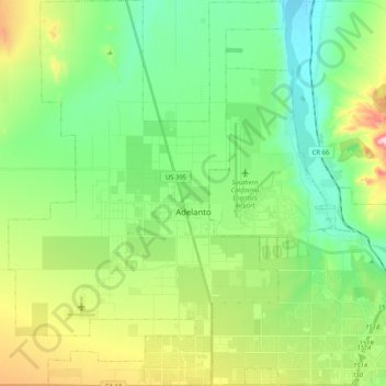
Name: Adelanto topographic map, elevation, terrain.

Location: Adelanto, San Bernardino County, California, 92342, United States (34.50649 -117.50745 34.67521 -117.36165)

Average elevation: 883 m

Minimum elevation: 767 m

Maximum elevation: 1,148 m

Gear up for your next adventure:

📦Gear Organizers - Organize outdoor equipment
🧥Packable Down Jackets - High warmth-to-weight ratio for summit breaks
🧤Thermal Outdoor Gloves - Windproof and waterproof gloves for winter hiking
🗾Ireland Map Books - Top map books for exploring Ireland
🛰️Handheld GPS Units - Professional satellite navigation for Irish highlands

As an Amazon Associate, this site earns from qualifying purchases at no extra cost to you.