Make a donation
Gear up for your next adventure:
As an Amazon Associate, this site earns from qualifying purchases at no extra cost to you.
Shrigley topographic map
Click on the map to display elevation.
Make a donation
Gear up for your next adventure:
As an Amazon Associate, this site earns from qualifying purchases at no extra cost to you.
About this map
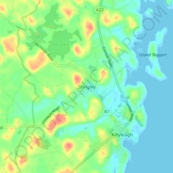
Name: Shrigley topographic map, elevation, terrain.
Average elevation: 18 m
Minimum elevation: -2 m
Maximum elevation: 58 m
Make a donation
Gear up for your next adventure:
As an Amazon Associate, this site earns from qualifying purchases at no extra cost to you.
Other topographic maps
Click on a map to view its topography, its elevation and its terrain.
County Antrim
United Kingdom > Northern Ireland
A large portion of Antrim is hilly, especially in the east, where the highest elevations are attained. The range runs north and south, and, following this direction, the highest points are Knocklayd 514 m (1,690 ft), Slieveanorra 508 m (1,670 ft), Trostan 550 m (1,800 ft), Slemish 437 m (1,430 ft), Agnew's…
Average elevation: 70 m
Make a donation
Gear up for your next adventure:
As an Amazon Associate, this site earns from qualifying purchases at no extra cost to you.
Make a donation
Gear up for your next adventure:
As an Amazon Associate, this site earns from qualifying purchases at no extra cost to you.
Make a donation
Gear up for your next adventure:
As an Amazon Associate, this site earns from qualifying purchases at no extra cost to you.
Make a donation
Gear up for your next adventure:
As an Amazon Associate, this site earns from qualifying purchases at no extra cost to you.
Make a donation
Gear up for your next adventure:
As an Amazon Associate, this site earns from qualifying purchases at no extra cost to you.
Make a donation
Gear up for your next adventure:
As an Amazon Associate, this site earns from qualifying purchases at no extra cost to you.
Derry and Strabane District
United Kingdom > Northern Ireland > County Tyrone
Average elevation: 140 m
Make a donation
Gear up for your next adventure:
As an Amazon Associate, this site earns from qualifying purchases at no extra cost to you.
Ballybarnes
United Kingdom > Northern Ireland > County Down > Bradshaw's Brae
Average elevation: 116 m
Make a donation
Gear up for your next adventure:
As an Amazon Associate, this site earns from qualifying purchases at no extra cost to you.
Foyle
United Kingdom > Northern Ireland > County Londonderry > Derry/Londonderry
Average elevation: 48 m
Make a donation
Gear up for your next adventure:
As an Amazon Associate, this site earns from qualifying purchases at no extra cost to you.
Make a donation
Gear up for your next adventure:
As an Amazon Associate, this site earns from qualifying purchases at no extra cost to you.
Causeway Coast and Glens District
United Kingdom > Northern Ireland > County Londonderry
Average elevation: 101 m
Make a donation
Gear up for your next adventure:
As an Amazon Associate, this site earns from qualifying purchases at no extra cost to you.
Make a donation
Gear up for your next adventure:
As an Amazon Associate, this site earns from qualifying purchases at no extra cost to you.
Mid and East Antrim District
United Kingdom > Northern Ireland > County Antrim
Average elevation: 111 m
Antrim and Newtownabbey District
United Kingdom > Northern Ireland > County Antrim
Average elevation: 97 m
Mid-Ulster District Council
United Kingdom > Northern Ireland > County Londonderry
Average elevation: 112 m
Make a donation
Gear up for your next adventure:
As an Amazon Associate, this site earns from qualifying purchases at no extra cost to you.
Make a donation
Gear up for your next adventure:
As an Amazon Associate, this site earns from qualifying purchases at no extra cost to you.
Make a donation
Gear up for your next adventure:
As an Amazon Associate, this site earns from qualifying purchases at no extra cost to you.
Drumahoe
United Kingdom > Northern Ireland > County Londonderry > Derry/Londonderry
Average elevation: 46 m
Make a donation
Gear up for your next adventure:
As an Amazon Associate, this site earns from qualifying purchases at no extra cost to you.
Make a donation
Gear up for your next adventure:
As an Amazon Associate, this site earns from qualifying purchases at no extra cost to you.
Make a donation
Gear up for your next adventure:
As an Amazon Associate, this site earns from qualifying purchases at no extra cost to you.
Antrim and Newtownabbey District
United Kingdom > Northern Ireland > County Antrim
Average elevation: 97 m
Mourne Esplanade Amentity Area
United Kingdom > Northern Ireland > County Down > Kilkeel
Average elevation: 14 m
Make a donation
Gear up for your next adventure:
As an Amazon Associate, this site earns from qualifying purchases at no extra cost to you.
Foyle
United Kingdom > Northern Ireland > County Londonderry > Derry/Londonderry
Average elevation: 48 m
Make a donation
Gear up for your next adventure:
As an Amazon Associate, this site earns from qualifying purchases at no extra cost to you.
Make a donation
Gear up for your next adventure:
As an Amazon Associate, this site earns from qualifying purchases at no extra cost to you.
Make a donation
Gear up for your next adventure:
As an Amazon Associate, this site earns from qualifying purchases at no extra cost to you.
Tollymore Forest
United Kingdom > Northern Ireland > County Down > Bryansford
Average elevation: 163 m
Lagan Navigation (Abandoned)
United Kingdom > Northern Ireland > County Antrim > Belfast
Average elevation: 29 m
Make a donation
Gear up for your next adventure:
As an Amazon Associate, this site earns from qualifying purchases at no extra cost to you.
Ballycullen
United Kingdom > Northern Ireland > County Down > Newtownards > Ballycullen
Average elevation: 49 m
Make a donation
Gear up for your next adventure:
As an Amazon Associate, this site earns from qualifying purchases at no extra cost to you.
Make a donation
Gear up for your next adventure:
As an Amazon Associate, this site earns from qualifying purchases at no extra cost to you.
