
Thank you for supporting this site ❤️
Make a donation
Make a donation
Gear up for your next adventure:
As an Amazon Associate, this site earns from qualifying purchases at no extra cost to you.
Cedrillas topographic map
Click on the map to display elevation.
Thank you for supporting this site ❤️
Make a donation
Make a donation
Gear up for your next adventure:
As an Amazon Associate, this site earns from qualifying purchases at no extra cost to you.
About this map
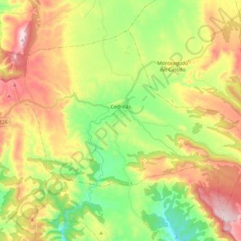
Name: Cedrillas topographic map, elevation, terrain.
Location: Cedrillas, Comunidad de Teruel, Teruel, Aragon, Spain (40.38176 -0.92666 40.47570 -0.76311)
Average elevation: 1,449 m
Minimum elevation: 1,215 m
Maximum elevation: 1,752 m
Thank you for supporting this site ❤️
Make a donation
Make a donation
Gear up for your next adventure:
As an Amazon Associate, this site earns from qualifying purchases at no extra cost to you.