
Thank you for supporting this site ❤️
Make a donation
Make a donation
Gear up for your next adventure:
As an Amazon Associate, this site earns from qualifying purchases at no extra cost to you.
Basac topographic map
Click on the map to display elevation.
Thank you for supporting this site ❤️
Make a donation
Make a donation
Gear up for your next adventure:
As an Amazon Associate, this site earns from qualifying purchases at no extra cost to you.
About this map
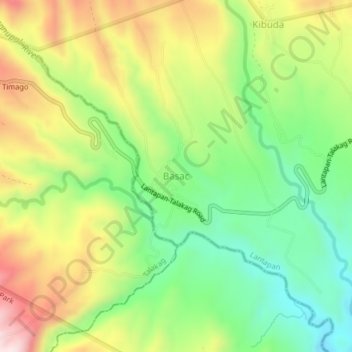
Name: Basac topographic map, elevation, terrain.
Location: Basac, Lantapan, Bukidnon, Northern Mindanao, Philippines (8.02228 124.84456 8.06228 124.88456)
Average elevation: 1,176 m
Minimum elevation: 959 m
Maximum elevation: 1,466 m
Thank you for supporting this site ❤️
Make a donation
Make a donation
Gear up for your next adventure:
As an Amazon Associate, this site earns from qualifying purchases at no extra cost to you.