Geolocate

Lyndhurst topographic map

Click on the map to display elevation.

About this map

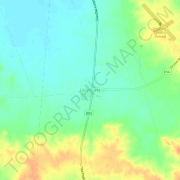
Name: Lyndhurst topographic map, elevation, terrain.

Location: Lyndhurst, Pastoral Unincorporated Area, South Australia, Australia (-30.30804 138.32878 -30.26804 138.36878)

Average elevation: 133 m

Minimum elevation: 118 m

Maximum elevation: 156 m

Gear up for your next adventure:

🎒Hiking Backpacks - Durable backpacks for day hikes and multi‑day treks
🏕️Family Camping Sets - Gear packages for family trips
📚Irish Walking Guides - The best mapped trails in Wicklow, Kerry, and Connemara
🧼Biodegradable Soaps - Eco‑friendly soap for backpacking
🔧Bicycle Repair Kits - On‑the‑go bike maintenance tools

As an Amazon Associate, this site earns from qualifying purchases at no extra cost to you.