
Thank you for supporting this site ❤️
Make a donation
Make a donation
Gear up for your next adventure:
As an Amazon Associate, this site earns from qualifying purchases at no extra cost to you.
Innisfail topographic map
Click on the map to display elevation.
Thank you for supporting this site ❤️
Make a donation
Make a donation
Gear up for your next adventure:
As an Amazon Associate, this site earns from qualifying purchases at no extra cost to you.
About this map
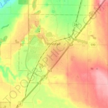
Name: Innisfail topographic map, elevation, terrain.
Location: Innisfail, Town of Innisfail, Alberta, T4G 1R1, Canada (51.98747 -113.99024 52.06747 -113.91024)
Average elevation: 942 m
Minimum elevation: 883 m
Maximum elevation: 1,024 m
Thank you for supporting this site ❤️
Make a donation
Make a donation
Gear up for your next adventure:
As an Amazon Associate, this site earns from qualifying purchases at no extra cost to you.