Geolocate

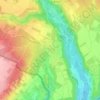
Chancy topographic map

Click on the map to display elevation.

About this map

Name: Chancy topographic map, elevation, terrain.

Location: Chancy, Geneva, 1284, Switzerland (46.12855 5.95591 46.16449 6.00581)

Average elevation: 392 m

Minimum elevation: 328 m

Maximum elevation: 465 m

Other topographic maps

Click on a map to view its topography, its elevation and its terrain.

Chambésy

Switzerland > Geneva

Average elevation: 401 m

Chambésy

Switzerland > Geneva

Average elevation: 401 m

Vessy

Switzerland > Geneva

Average elevation: 421 m

Grands-Bois

Switzerland > Geneva > Bellevue > Bellevue

Average elevation: 408 m

Vésenaz

Switzerland > Geneva

Average elevation: 412 m

Pregny

Switzerland > Geneva

Average elevation: 407 m

Pregny

Switzerland > Geneva

Average elevation: 407 m

Ecogia

Switzerland > Geneva > Versoix

Average elevation: 418 m

Pressy

Switzerland > Geneva > Vandœuvres

Average elevation: 430 m

Dardagny Castle

Switzerland > Geneva > Dardagny

Average elevation: 431 m

Gear up for your next adventure:

🗺️Topographic Maps - Detailed maps for hiking, cycling and planning routes
🪓Camping Hand Axes - For processing wood during forest camping
🎒Technical Hiking Daypacks - Ergonomic backpacks with hydration bladder compatibility
🔭Laser Distance Meters - Professional precision measuring for site surveys
🧿Outdoor Gadgets - Innovative tools for outdoor enthusiasts

As an Amazon Associate, this site earns from qualifying purchases at no extra cost to you.