Geolocate

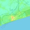
Puri topographic map

Click on the map to display elevation.

About this map

Name: Puri topographic map, elevation, terrain.

Location: Puri, Puri (M), Puri, Odisha, 752001, India (19.64761 85.66525 19.96761 85.98525)

Average elevation: 4 m

Minimum elevation: -2 m

Maximum elevation: 25 m

Other topographic maps

Click on a map to view its topography, its elevation and its terrain.
Puri

India > Odisha > Puri (M)

Average elevation: 6 m

Puri

India > Odisha > Puri (M)

Average elevation: 6 m

Puri

India > Odisha > Puri (M)

Average elevation: 6 m

Gear up for your next adventure:

⛺Ultralight Hiking Tents - Compact shelters for multi-day wild camping in Ireland
🧤Touchscreen Glove Liners - Use your mapping app without freezing your hands
🧊Hydration Reservoirs - Easy drinking on the move with 2L or 3L bladders
🎽Thermal Base Layers - Essential moisture management for cold weather
🧶Camping String Lights - Ambience and utility lighting

As an Amazon Associate, this site earns from qualifying purchases at no extra cost to you.