
Thank you for supporting this site ❤️
Make a donation
Make a donation
Gear up for your next adventure:
As an Amazon Associate, this site earns from qualifying purchases at no extra cost to you.
Heisterberg topographic map
Click on the map to display elevation.
Thank you for supporting this site ❤️
Make a donation
Make a donation
Gear up for your next adventure:
As an Amazon Associate, this site earns from qualifying purchases at no extra cost to you.
About this map
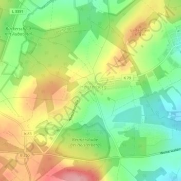
Name: Heisterberg topographic map, elevation, terrain.
Location: Heisterberg, Driedorf, Lahn-Dill-Kreis, Hessen, Duitsland (50.64817 8.13745 50.66904 8.16893)
Average elevation: 571 m
Minimum elevation: 511 m
Maximum elevation: 645 m
Thank you for supporting this site ❤️
Make a donation
Make a donation
Gear up for your next adventure:
As an Amazon Associate, this site earns from qualifying purchases at no extra cost to you.