
Pottenstein topographic map
Interactive map
Click on the map to display elevation.
About this map
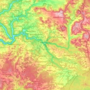
Name: Pottenstein topographic map, elevation, terrain.
Location: Pottenstein, Landkreis Bayreuth, Bayern, 91278, Deutschland (49.70041 11.34736 49.83621 11.49116)
Average elevation: 471 m
Minimum elevation: 318 m
Maximum elevation: 615 m
Pottenstein befindet sich im Naturpark Fränkische Schweiz/Veldensteiner Forst. In der Nähe des Gemeindeteils Hohenmirsberg liegt die Hohenmirsberger Platte (Aussichtsturm auf 614 m Höhe; einer der höchsten Punkte in der Fränkischen Schweiz). Durch den Ortskern fließt die Püttlach, in die der Haselbrunnbach und nahe dem Kurpark der Weihersbach mündet. Das gemeindefreie Gebiet Prüll liegt östlich des Hauptortes und wird komplett vom Gemeindegebiet umschlossen.
Other topographic maps
Click on a map to view its topography, its elevation and its terrain.
Warmensteinach
Deutschland > Bayern > Landkreis Bayreuth
Warmensteinach, Landkreis Bayreuth, Bayern, 95485, Deutschland
Average elevation: 738 m
Speichersdorf
Deutschland > Bayern > Landkreis Bayreuth
Speichersdorf, Landkreis Bayreuth, Bayern, 95469, Deutschland
Average elevation: 482 m
Glashütten
Deutschland > Bayern > Landkreis Bayreuth
Glashütten, Mistelgau (VGem), Landkreis Bayreuth, Bayern, 95496, Deutschland
Average elevation: 468 m
Mehlmeisel
Deutschland > Bayern > Landkreis Bayreuth
Mehlmeisel, Landkreis Bayreuth, Bayern, 95694, Deutschland
Average elevation: 670 m
Veldensteiner Forst
Deutschland > Bayern > Landkreis Bayreuth
Veldensteiner Forst, Landkreis Bayreuth, Bayern, Deutschland
Average elevation: 450 m
Bad Berneck im Fichtelgebirge
Deutschland > Bayern > Landkreis Bayreuth
Bad Berneck im Fichtelgebirge, Landkreis Bayreuth, Bayern, 95460, Deutschland
Average elevation: 521 m
Goldkronach
Deutschland > Bayern > Landkreis Bayreuth
Goldkronach, Landkreis Bayreuth, Bayern, 95497, Deutschland
Average elevation: 527 m
Aufseß
Deutschland > Bayern > Landkreis Bayreuth > Aufseß
Aufseß, Hollfeld (VGem), Landkreis Bayreuth, Bayern, 91347, Deutschland
Average elevation: 445 m