
Laufen-Uhwiesen topographic map
Interactive map
Click on the map to display elevation.
About this map
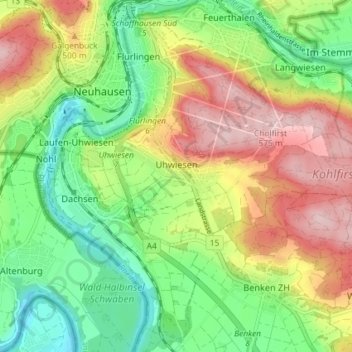
Name: Laufen-Uhwiesen topographic map, elevation, terrain.
Location: Laufen-Uhwiesen, Bezirk Andelfingen, Zurich, 8248, Suisse (47.65985 8.60614 47.67883 8.67904)
Average elevation: 447 m
Minimum elevation: 350 m
Maximum elevation: 573 m
Other topographic maps
Click on a map to view its topography, its elevation and its terrain.
Nohl
Suisse > Zurich > Bezirk Andelfingen
Nohl, Laufen-Uhwiesen, Bezirk Andelfingen, Zurich, 8248, Suisse
Average elevation: 439 m