
City of Albany topographic map
Interactive map
Click on the map to display elevation.
About this map
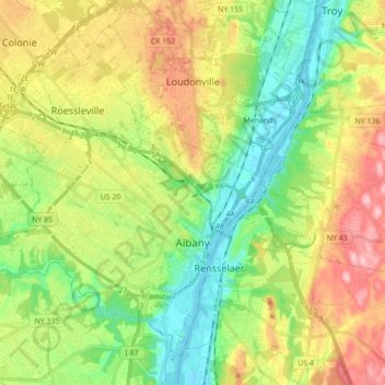
Name: City of Albany topographic map, elevation, terrain.
Location: City of Albany, Albany County, New York, United States (42.61353 -73.89746 42.72213 -73.72323)
Average elevation: 68 m
Minimum elevation: -2 m
Maximum elevation: 169 m