
Elmwood topographic map
Interactive map
Click on the map to display elevation.
About this map
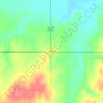
Name: Elmwood topographic map, elevation, terrain.
Location: Elmwood, Beaver County, Oklahoma, United States (36.59650 -100.54258 36.63650 -100.50258)
Average elevation: 814 m
Minimum elevation: 784 m
Maximum elevation: 856 m
Other topographic maps
Click on a map to view its topography, its elevation and its terrain.
Balko
United States > Oklahoma > Beaver County
Balko, Beaver County, Oklahoma, United States
Average elevation: 860 m
Beaver
United States > Oklahoma > Beaver County > Beaver > Beaver
Beaver, Beaver County, Oklahoma, 73932, United States
Average elevation: 754 m
Turpin
United States > Oklahoma > Beaver County > Turpin
Turpin, Beaver County, Oklahoma, 73950, United States
Average elevation: 836 m