
Pacitan topographic map
Interactive map
Click on the map to display elevation.
About this map
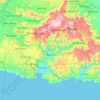
Name: Pacitan topographic map, elevation, terrain.
Location: Pacitan, East Java, Indonesia (-8.28479 110.89872 -7.91875 111.42658)
Average elevation: 296 m
Minimum elevation: -1 m
Maximum elevation: 1,195 m
Other topographic maps
Click on a map to view its topography, its elevation and its terrain.