
Thank you for supporting this site ❤️
Make a donation
Make a donation
Gear up for your next adventure:
As an Amazon Associate, this site earns from qualifying purchases at no extra cost to you.
Town topographic map
Click on the map to display elevation.
Thank you for supporting this site ❤️
Make a donation
Make a donation
Gear up for your next adventure:
As an Amazon Associate, this site earns from qualifying purchases at no extra cost to you.
About this map
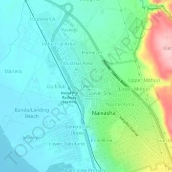
Name: Town topographic map, elevation, terrain.
Location: Town, Viwandani ward, Naivasha, Nakuru, Rift Valley, Kenya (-0.73617 36.41468 -0.69617 36.45468)
Average elevation: 1,929 m
Minimum elevation: 1,882 m
Maximum elevation: 2,079 m
Thank you for supporting this site ❤️
Make a donation
Make a donation
Gear up for your next adventure:
As an Amazon Associate, this site earns from qualifying purchases at no extra cost to you.