
Thank you for supporting this site ❤️
Make a donation
Make a donation
Gear up for your next adventure:
As an Amazon Associate, this site earns from qualifying purchases at no extra cost to you.
Aliyar topographic map
Click on the map to display elevation.
Thank you for supporting this site ❤️
Make a donation
Make a donation
Gear up for your next adventure:
As an Amazon Associate, this site earns from qualifying purchases at no extra cost to you.
About this map
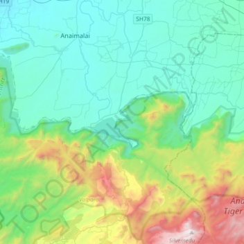
Name: Aliyar topographic map, elevation, terrain.
Location: Aliyar, Attakatty, Valparai, Coimbatore, Tamil Nadu, India (10.33785 76.93899 10.62367 77.09826)
Average elevation: 704 m
Minimum elevation: 187 m
Maximum elevation: 2,503 m
Thank you for supporting this site ❤️
Make a donation
Make a donation
Gear up for your next adventure:
As an Amazon Associate, this site earns from qualifying purchases at no extra cost to you.