
Muldoon topographic map
Click on the map to display elevation.
About this map
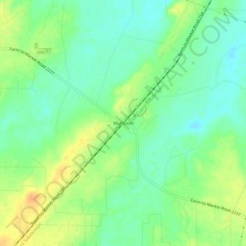
Name: Muldoon topographic map, elevation, terrain.
Location: Muldoon, Fayette County, Texas, 78949, United States (29.79578 -97.09110 29.83578 -97.05110)
Average elevation: 104 m
Minimum elevation: 89 m
Maximum elevation: 125 m
Other topographic maps
Click on a map to view its topography, its elevation and its terrain.
La Grange
United States > Texas > Fayette County
The center of La Grange has an elevation of 266 feet (81 m) above sea level.
Average elevation: 91 m