
Situbondo topographic map
Interactive map
Click on the map to display elevation.
About this map
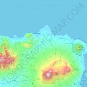
Name: Situbondo topographic map, elevation, terrain.
Location: Situbondo, East Java, Indonesia (-7.99302 113.57253 -7.60410 114.46723)
Average elevation: 240 m
Minimum elevation: 0 m
Maximum elevation: 3,227 m
Other topographic maps
Click on a map to view its topography, its elevation and its terrain.