
Thank you for supporting this site ❤️
Make a donation
Make a donation
Gear up for your next adventure:
As an Amazon Associate, this site earns from qualifying purchases at no extra cost to you.
Kamara topographic map
Click on the map to display elevation.
Thank you for supporting this site ❤️
Make a donation
Make a donation
Gear up for your next adventure:
As an Amazon Associate, this site earns from qualifying purchases at no extra cost to you.
About this map
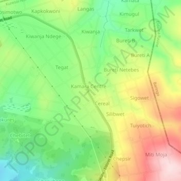
Name: Kamara topographic map, elevation, terrain.
Location: Kamara, Kamara ward, Kuresoi North, Nakuru, Rift Valley, Kenya (-0.11742 35.65666 -0.07742 35.69666)
Average elevation: 2,542 m
Minimum elevation: 2,412 m
Maximum elevation: 2,717 m
Thank you for supporting this site ❤️
Make a donation
Make a donation
Gear up for your next adventure:
As an Amazon Associate, this site earns from qualifying purchases at no extra cost to you.