
Thank you for supporting this site ❤️
Make a donation
Make a donation
Gear up for your next adventure:
As an Amazon Associate, this site earns from qualifying purchases at no extra cost to you.
09432 topographic map
Click on the map to display elevation.
Thank you for supporting this site ❤️
Make a donation
Make a donation
Gear up for your next adventure:
As an Amazon Associate, this site earns from qualifying purchases at no extra cost to you.
About this map
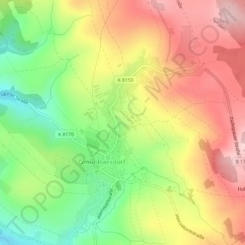
Name: 09432 topographic map, elevation, terrain.
Location: 09432, Großolbersdorf, Erzgebirgskreis, Sachsen, Deutschland (50.69782 13.09179 50.69792 13.09189)
Average elevation: 530 m
Minimum elevation: 417 m
Maximum elevation: 635 m
Thank you for supporting this site ❤️
Make a donation
Make a donation
Gear up for your next adventure:
As an Amazon Associate, this site earns from qualifying purchases at no extra cost to you.