Geolocate

Gettysburg topographic map

Click on the map to display elevation.

About this map

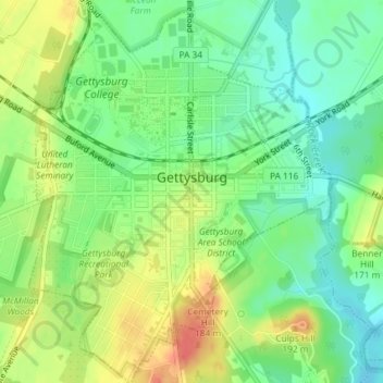
Name: Gettysburg topographic map, elevation, terrain.

Location: Gettysburg, Adams County, Pennsylvania, 17325, United States (39.81581 -77.24664 39.84384 -77.21762)

Average elevation: 161 m

Minimum elevation: 138 m

Maximum elevation: 192 m

Gear up for your next adventure:

🩴Trail Running Shoes - Fast, grippy shoes for trail runs
🛍️Outdoor Accessory Kits - Bundles for new hikers
📊Altimeters & Barometers - Track elevation and weather changes
🔋Rechargeable Batteries - Eco-friendly power for headlamps and GPS units
🧦Merino Wool Socks - Moisture-wicking and blister-preventing trail socks

As an Amazon Associate, this site earns from qualifying purchases at no extra cost to you.