
Thank you for supporting this site ❤️
Make a donation
Make a donation
Gear up for your next adventure:
As an Amazon Associate, this site earns from qualifying purchases at no extra cost to you.
Pescul topographic map
Click on the map to display elevation.
Thank you for supporting this site ❤️
Make a donation
Make a donation
Gear up for your next adventure:
As an Amazon Associate, this site earns from qualifying purchases at no extra cost to you.
About this map
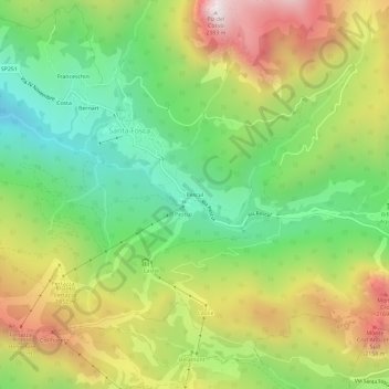
Name: Pescul topographic map, elevation, terrain.
Location: Pescul, Santa Fosca, Selva di Cadore, Belluno, Veneto, Italy (46.41741 12.05148 46.45741 12.09148)
Average elevation: 1,703 m
Minimum elevation: 1,228 m
Maximum elevation: 2,358 m
Thank you for supporting this site ❤️
Make a donation
Make a donation
Gear up for your next adventure:
As an Amazon Associate, this site earns from qualifying purchases at no extra cost to you.