Geolocate

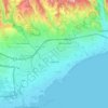
Limassol topographic map

Click on the map to display elevation.

About this map

Name: Limassol topographic map, elevation, terrain.

Location: Limassol, Limassol Municipality, Limassol District, Cyprus, 3085, Cyprus (34.52529 32.87327 34.84529 33.19327)

Average elevation: 176 m

Minimum elevation: -5 m

Maximum elevation: 1,046 m

Other topographic maps

Click on a map to view its topography, its elevation and its terrain.
Paphos Municipality

Cyprus > Cyprus

Average elevation: 57 m

Limassol

Cyprus > Cyprus > Limassol Municipality

Average elevation: 71 m

Gear up for your next adventure:

📍Trail Markers & GPS - Tools to track and mark trails
🔧Bicycle Repair Kits - On‑the‑go bike maintenance tools
👣Orthopedic Boot Insoles - Extra comfort for long distance walking
🚶‍♂️Trekking Poles - Supportive poles for stability on varied terrain
🧊Hydration Reservoirs - Easy drinking on the move with 2L or 3L bladders

As an Amazon Associate, this site earns from qualifying purchases at no extra cost to you.