
Paphos Municipality topographic map
Interactive map
Click on the map to display elevation.
About this map
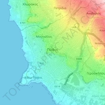
Name: Paphos Municipality topographic map, elevation, terrain.
Location: Paphos Municipality, Paphos District, Cyprus (34.74319 32.39980 34.80175 32.46575)
Average elevation: 57 m
Minimum elevation: 0 m
Maximum elevation: 235 m
Other topographic maps
Click on a map to view its topography, its elevation and its terrain.