
Sahibzada Ajit Singh Nagar topographic map
Interactive map
Click on the map to display elevation.
About this map
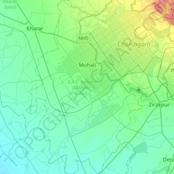
Name: Sahibzada Ajit Singh Nagar topographic map, elevation, terrain.
Location: Sahibzada Ajit Singh Nagar, Punjab, India (30.57029 76.63072 30.78330 76.79735)
Average elevation: 311 m
Minimum elevation: 275 m
Maximum elevation: 465 m
Other topographic maps
Click on a map to view its topography, its elevation and its terrain.
Maur
India > Punjab > Talwandi Sabo Tahsil
Maur is located at 30°05′N 75°15′E / 30.08°N 75.25°E / 30.08; 75.25.[1] It has an average elevation of 212 metres (695 feet).Situated on Bathinda Mansa road at a distance of 35 km from Bathinda, the district headquarters, Maur (also called Maur Mandi) is a railway station on the Firozpur -…
Average elevation: 216 m