
Brennilis topographic map
Interactive map
Click on the map to display elevation.
About this map
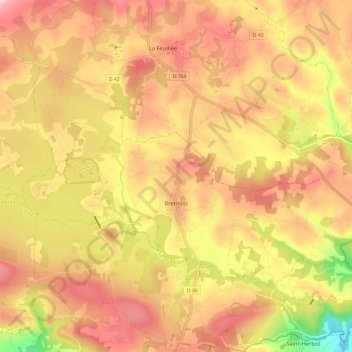
Name: Brennilis topographic map, elevation, terrain.
Average elevation: 237 m
Minimum elevation: 91 m
Maximum elevation: 330 m
Other topographic maps
Click on a map to view its topography, its elevation and its terrain.
Châteauneuf-du-Faou
France > Brittany > Finistère > Châteauneuf-du-Faou
Châteauneuf-du-Faou, Châteaulin, Finistère, Brittany, Metropolitan France, 29520, France
Average elevation: 115 m