
Zöblen topographic map
Interactive map
Click on the map to display elevation.
About this map
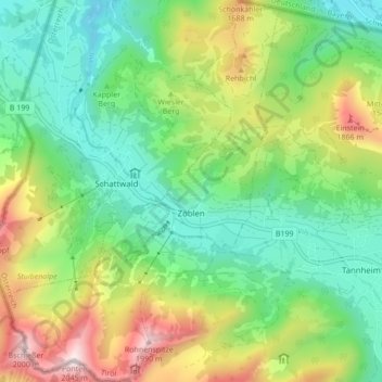
Name: Zöblen topographic map, elevation, terrain.
Location: Zöblen, Bezirk Reutte, Österreich (47.48242 10.43572 47.54040 10.49776)
Average elevation: 1,334 m
Minimum elevation: 983 m
Maximum elevation: 2,019 m
Die komplette Liste der Statistik Austria ist in: Topographische Siedlungskennzeichnung nach STAT