
Thank you for supporting this site ❤️
Make a donation
Make a donation
Gear up for your next adventure:
As an Amazon Associate, this site earns from qualifying purchases at no extra cost to you.
Saravillo topographic map
Click on the map to display elevation.
Thank you for supporting this site ❤️
Make a donation
Make a donation
Gear up for your next adventure:
As an Amazon Associate, this site earns from qualifying purchases at no extra cost to you.
About this map
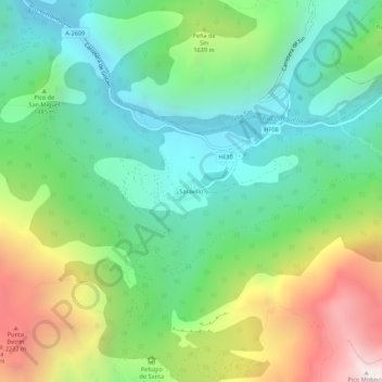
Name: Saravillo topographic map, elevation, terrain.
Location: Saravillo, Plan, Sobrarbe, Huesca, Aragon, 22366, Spain (42.53430 0.23823 42.57430 0.27823)
Average elevation: 1,416 m
Minimum elevation: 820 m
Maximum elevation: 2,593 m
Thank you for supporting this site ❤️
Make a donation
Make a donation
Gear up for your next adventure:
As an Amazon Associate, this site earns from qualifying purchases at no extra cost to you.