
Asheville topographic map
Interactive map
Click on the map to display elevation.
About this map
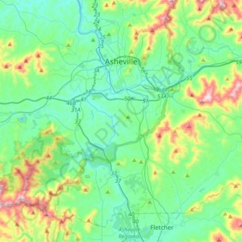
Name: Asheville topographic map, elevation, terrain.
Location: Asheville, Buncombe County, North Carolina, USA (35.41647 -82.67102 35.65612 -82.45994)
Average elevation: 727 m
Minimum elevation: 578 m
Maximum elevation: 1,209 m