
Castlebar topographic map
Interactive map
Click on the map to display elevation.
About this map
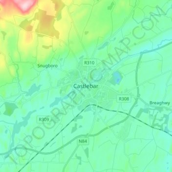
Name: Castlebar topographic map, elevation, terrain.
Location: Castlebar, County Mayo, Connacht, F23 WF90, Ireland (53.81684 -9.33797 53.89684 -9.25797)
Average elevation: 56 m
Minimum elevation: 9 m
Maximum elevation: 240 m