
Thank you for supporting this site ❤️
Make a donation
Make a donation
Gear up for your next adventure:
As an Amazon Associate, this site earns from qualifying purchases at no extra cost to you.
Kinoru topographic map
Click on the map to display elevation.
Thank you for supporting this site ❤️
Make a donation
Make a donation
Gear up for your next adventure:
As an Amazon Associate, this site earns from qualifying purchases at no extra cost to you.
About this map
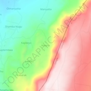
Name: Kinoru topographic map, elevation, terrain.
Location: Kinoru, Waseges ward, Subukia, Nakuru, Rift Valley, Kenya (0.05800 36.24151 0.09800 36.28151)
Average elevation: 2,125 m
Minimum elevation: 1,785 m
Maximum elevation: 2,482 m
Thank you for supporting this site ❤️
Make a donation
Make a donation
Gear up for your next adventure:
As an Amazon Associate, this site earns from qualifying purchases at no extra cost to you.