
Thank you for supporting this site ❤️
Make a donation
Make a donation
Gear up for your next adventure:
As an Amazon Associate, this site earns from qualifying purchases at no extra cost to you.
Huliyurudurga topographic map
Click on the map to display elevation.
Thank you for supporting this site ❤️
Make a donation
Make a donation
Gear up for your next adventure:
As an Amazon Associate, this site earns from qualifying purchases at no extra cost to you.
About this map
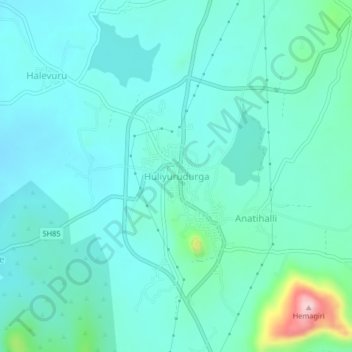
Name: Huliyurudurga topographic map, elevation, terrain.
Location: Huliyurudurga, Kunigal taluk, Tumakuru, Karnataka, India (12.80819 77.01346 12.84819 77.05346)
Average elevation: 719 m
Minimum elevation: 675 m
Maximum elevation: 943 m
Thank you for supporting this site ❤️
Make a donation
Make a donation
Gear up for your next adventure:
As an Amazon Associate, this site earns from qualifying purchases at no extra cost to you.