Geolocate

Reading topographic map

Click on the map to display elevation.

About this map
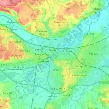
Name: Reading topographic map, elevation, terrain.

Location: Reading, England, United Kingdom (51.41237 -1.06102 51.49189 -0.88025)

Average elevation: 58 m

Minimum elevation: 30 m

Maximum elevation: 126 m

Gear up for your next adventure:

🚨High-Decibel Whistles - Standard safety gear for mountain signaling
📡Satellite Messengers - Emergency messaging when off‑grid
💡Hiking Headlamps - Hands‑free lights for night hikes
🪶Down Jackets - Warm jackets for cold outdoor trips
🔋Solar Power Banks - Keep your GPS and phone charged in the Irish wilderness

As an Amazon Associate, this site earns from qualifying purchases at no extra cost to you.