
Thank you for supporting this site ❤️
Make a donation
Make a donation
Gear up for your next adventure:
As an Amazon Associate, this site earns from qualifying purchases at no extra cost to you.
Mae Rim topographic map
Click on the map to display elevation.
Thank you for supporting this site ❤️
Make a donation
Make a donation
Gear up for your next adventure:
As an Amazon Associate, this site earns from qualifying purchases at no extra cost to you.
About this map
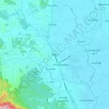
Name: Mae Rim topographic map, elevation, terrain.
Location: Mae Rim, Rim Nuea, Chiang Mai Province, 50180, Thailand (18.87446 98.90527 18.95446 98.98527)
Average elevation: 340 m
Minimum elevation: 309 m
Maximum elevation: 721 m
Thank you for supporting this site ❤️
Make a donation
Make a donation
Gear up for your next adventure:
As an Amazon Associate, this site earns from qualifying purchases at no extra cost to you.