Geolocate

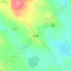
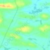
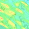
Granny topographic map

Click on the map to display elevation.

About this map

Name: Granny topographic map, elevation, terrain.

Location: Granny, Esternow ED, Boyle Municipal District, County Roscommon, Connacht, Ireland (53.91004 -8.33471 53.92111 -8.28470)

Average elevation: 93 m

Minimum elevation: 70 m

Maximum elevation: 123 m

Other topographic maps

Click on a map to view its topography, its elevation and its terrain.
Arigna

Ireland > County Roscommon

Average elevation: 122 m

Rahara

Ireland > County Roscommon

Average elevation: 88 m

Roosky

Ireland > County Roscommon

Average elevation: 46 m

Rathcroghan Mound

Ireland > County Roscommon

Average elevation: 127 m

Doon Point

Ireland > County Roscommon

Average elevation: 66 m

Ballinphuill

Ireland > County Roscommon

Average elevation: 57 m

Scramoge

Ireland > County Roscommon > Scramoge

Average elevation: 70 m

Ballybay

Ireland > County Roscommon

Average elevation: 40 m

Lisacul

Ireland > County Roscommon

Average elevation: 82 m

Granlahan

Ireland > County Roscommon

Average elevation: 105 m

Boyle Canal

Ireland > County Roscommon > Boyle

Average elevation: 68 m

Rathcroghan Mound

Ireland > County Roscommon

Average elevation: 127 m

Termon River

Ireland > County Roscommon

Average elevation: 75 m

Gear up for your next adventure:

🥄Titanium Sporks - Indestructible and ultralight eating utensil
🧤Touchscreen Glove Liners - Use your mapping app without freezing your hands
⛺Emergency Bivvy Bags - Life-saving heat-reflective shelter for emergencies
🔦Everyday Carry Torches - Reliable backup light for your hiking pack
🧉Camping Coffee Gear - Enjoy coffee outdoors

As an Amazon Associate, this site earns from qualifying purchases at no extra cost to you.