
Thank you for supporting this site ❤️
Make a donation
Make a donation
Gear up for your next adventure:
As an Amazon Associate, this site earns from qualifying purchases at no extra cost to you.
Deanbank topographic map
Click on the map to display elevation.
Thank you for supporting this site ❤️
Make a donation
Make a donation
Gear up for your next adventure:
As an Amazon Associate, this site earns from qualifying purchases at no extra cost to you.
About this map
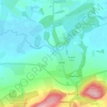
Name: Deanbank topographic map, elevation, terrain.
Location: Deanbank, Glamis, Angus, Scotland, DD8 1QG, United Kingdom (56.59674 -3.03687 56.63674 -2.99687)
Average elevation: 83 m
Minimum elevation: 48 m
Maximum elevation: 205 m
Thank you for supporting this site ❤️
Make a donation
Make a donation
Gear up for your next adventure:
As an Amazon Associate, this site earns from qualifying purchases at no extra cost to you.