Geolocate

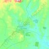
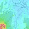
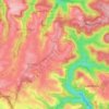
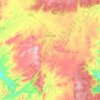
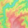
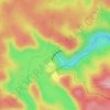
Little Murray topographic map

Click on the map to display elevation.

About this map

Name: Little Murray topographic map, elevation, terrain.

Location: Little Murray, Bellingen Shire Council, New South Wales, Australia (-30.39993 152.53873 -30.39983 152.53883)

Average elevation: 1,094 m

Minimum elevation: 552 m

Maximum elevation: 1,365 m

Other topographic maps

Click on a map to view its topography, its elevation and its terrain.
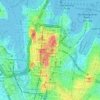
Sydney

Australia > New South Wales

Sydney's topography is characterized by a diverse landscape that seamlessly blends coastal features with inland plateaus. The city is divided into two primary regions: the relatively flat Cumberland Plain to the south and west of Sydney Harbour, and the elevated Hornsby Plateau to the north. The Cumberland…

Average elevation: 51 m

Bar Point

Australia > New South Wales

Average elevation: 76 m

Katoomba

Australia > New South Wales

Average elevation: 904 m

Newcastle

Australia > New South Wales > Newcastle

Average elevation: 5 m

Mudgee

Australia > New South Wales

Average elevation: 535 m

Tocumwal

Australia > New South Wales

Average elevation: 112 m

Moruya Heads

Australia > New South Wales

Average elevation: 9 m

Gulgong

Australia > New South Wales

Average elevation: 454 m

Karangi

Australia > New South Wales

Average elevation: 173 m

Penrith

Australia > New South Wales > Sydney > Penrith

Penrith is a city in New South Wales, Australia, located in Greater Western Sydney, 55 kilometres (31 mi) west of the Sydney central business district on the banks of the Nepean River, on the outskirts of the Cumberland Plain. Its elevation is 32 metres (105 ft).

Average elevation: 34 m
Windsor

Australia > New South Wales

Average elevation: 12 m

Parramatta

Australia > New South Wales

Average elevation: 22 m

Armidale

Australia > New South Wales

Average elevation: 1,036 m

Drake

Australia > New South Wales

Average elevation: 505 m

Barrington Tops

Australia > New South Wales

Average elevation: 1,107 m

Mittagong

Australia > New South Wales

Average elevation: 672 m

Manly

Australia > New South Wales

Average elevation: 17 m

Wauchope

Australia > New South Wales

Average elevation: 32 m

Ocean Shores

Australia > New South Wales

Average elevation: 12 m

Wentworth Falls

Australia > New South Wales > Sydney

Wentworth Falls (postcode: 2782) is a town in the Blue Mountains region of New South Wales, situated approximately 100 kilometres (62 mi) west of the Sydney central business district, and about 8 kilometres (5.0 mi) east of Katoomba, Australia on the Great Western Highway, with a Wentworth Falls railway…

Average elevation: 708 m

Tweed Shire Council

Australia > New South Wales

Average elevation: 212 m

Buff Point

Australia > New South Wales

Average elevation: 9 m

Nobbys Creek

Australia > New South Wales

Average elevation: 66 m

Burramoko Ridge

Australia > New South Wales

Average elevation: 920 m

Urunga

Australia > New South Wales

Average elevation: 13 m

St Ives

Australia > New South Wales > Sydney

Average elevation: 125 m

Avoca Beach

Australia > New South Wales

Average elevation: 23 m

Nimmitabel

Australia > New South Wales

Average elevation: 1,051 m

Kellyville

Australia > New South Wales

Average elevation: 70 m

Northern Beaches

Australia > New South Wales > Sydney

Average elevation: 67 m

Lismore

Australia > New South Wales

Average elevation: 23 m

Tenterfield

Australia > New South Wales

Average elevation: 891 m

Ellalong

Australia > New South Wales

Average elevation: 162 m

Moruya

Australia > New South Wales

Average elevation: 37 m

Scotts Head

Australia > New South Wales

Average elevation: 5 m

Baulkham Hills

Australia > New South Wales > Sydney

Average elevation: 93 m

Epping

Australia > New South Wales > Sydney

Average elevation: 96 m

Zetland

Australia > New South Wales > Sydney

Average elevation: 26 m

Sydney

Australia > New South Wales > Sydney

Average elevation: 23 m

Dubbo

Australia > New South Wales

Average elevation: 318 m

Carabost

Australia > New South Wales

Average elevation: 484 m

Akolele

Australia > New South Wales

Average elevation: 15 m

Scotland Island

Australia > New South Wales > Sydney

Average elevation: 17 m

Port Macquarie

Australia > New South Wales

Average elevation: 5 m

Byron Bay

Australia > New South Wales

Byron Bay, located in northeastern New South Wales, Australia, is characterized by diverse topography shaped by its geological history. The town is part of the erosion caldera of the ancient Tweed Volcano, which erupted approximately 23 million years ago, resulting in the rich volcanic soils that define the…

Average elevation: 7 m

Kurnell

Australia > New South Wales > Sydney

Average elevation: 4 m

Terrey Hills

Australia > New South Wales > Sydney

Owing to its elevation and close proximity to the ocean, as well as its extensive tree canopy cover, the weather station at Terrey Hills records the mildest temperatures of any weather station in the Greater Sydney region. Under Köppen's scheme, the suburb has a borderline humid subtropical (Cfa) and oceanic…

Average elevation: 146 m
Woolgoolga

Australia > New South Wales

Average elevation: 29 m

Engadine

Australia > New South Wales > Sydney

Average elevation: 121 m

Thornleigh

Australia > New South Wales > Sydney

Thornleigh is bounded to the north by Waitara Creek and south by the Lane Cove National Park. Thornleigh borders the suburbs of Normanhurst, Hornsby, Wahroonga, Westleigh and Pennant Hills. Thornleigh offers great district views, and the topography varies greatly with many established areas built around…

Average elevation: 159 m

Blacktown

Australia > New South Wales > Sydney

Average elevation: 57 m

Blue Mountains

Australia > New South Wales

A sandstone plateau dominated by a landscape of endless eucalyptus forests, the Blue Mountains are located at the top of a 470-million-year-old quartzite. In the Permian period, a shallow sea covered the region, when rivers brought shales, siltstones and mudstones. Then during the Mesozoic period, rivers…

Average elevation: 566 m

Ulong

Australia > New South Wales

Average elevation: 559 m

Four Mile Creek

Australia > New South Wales

Average elevation: 831 m

Oakhurst

Australia > New South Wales > Sydney

Average elevation: 49 m

Paxton

Australia > New South Wales

Average elevation: 125 m

Newport

Australia > New South Wales > Sydney

Average elevation: 27 m

Sawyers Gully

Australia > New South Wales

Average elevation: 56 m

Goulburn

Australia > New South Wales

Owing to its elevation, Goulburn has an oceanic climate (Cfb) with warm summers and cool winters; with a high diurnal range. Its climate is variable much of the year, though generally dry with maximum temperatures ranging from 11.8 °C (53.2 °F) in July to 28.3 °C (82.9 °F) in January. Rainfall is…

Average elevation: 666 m

Alstonville

Australia > New South Wales

Average elevation: 131 m

Chatswood

Australia > New South Wales

Average elevation: 81 m

Asquith

Australia > New South Wales

Average elevation: 168 m

Glenorie

Australia > New South Wales

Average elevation: 131 m

Caves Beach

Australia > New South Wales

Average elevation: 22 m

Gulmarrad

Australia > New South Wales

Average elevation: 10 m

Moonan Brook

Australia > New South Wales

Average elevation: 712 m

Laurel Hill

Australia > New South Wales

Average elevation: 990 m

Tyalgum Creek

Australia > New South Wales

Average elevation: 346 m

Bonalbo

Australia > New South Wales

Average elevation: 263 m

Wagga Wagga

Australia > New South Wales

Average elevation: 183 m

Orange

Australia > New South Wales

Orange is a city in the Central Tablelands region of New South Wales, Australia. It is 254 km (158 mi) west of the state capital, Sydney [206 km (128 mi) on a great circle], at an altitude of 862 metres (2,828 ft). Orange had an estimated urban population of 40,493 as of June 2018 making the city a significant…

Average elevation: 852 m

Carcoar

Australia > New South Wales

Average elevation: 818 m

Cooma

Australia > New South Wales

Average elevation: 869 m

Werri Beach

Australia > New South Wales

Average elevation: 9 m

Pooncarie

Australia > New South Wales > Pooncarie

Average elevation: 68 m

Bilambil Heights

Australia > New South Wales

Average elevation: 41 m

Batehaven

Australia > New South Wales

Average elevation: 16 m

Fingal Bay

Australia > New South Wales

Average elevation: 13 m

Bents Basin State Conservation Area

Australia > New South Wales > Sydney

The park is popular for swimming, kayaking, bushwalking, camping (with 100 tent sites), barbecuing, picnicking and fishing. The park also features walking trails within a bushland and an education centre with a commercial kitchen. Caley's Lookout Track, a walking track within the bushland, leads to Little…

Average elevation: 82 m

Booral

Australia > New South Wales

Average elevation: 98 m

Bargo

Australia > New South Wales

Average elevation: 346 m

Woronora Dam

Australia > New South Wales

The wall of Woronora Dam is an engineering work imbued with a sense of high aesthetic value expressed through the long curved high wall set with the wide valley of the Woronora River. Upstream of the dam wall this setting is characterised by the broad expanse of the pool of water bordered by the crests of the…

Average elevation: 198 m

Swan Bay

Australia > New South Wales

Average elevation: 5 m

Wellington

Australia > New South Wales

Average elevation: 321 m

Oallen

Australia > New South Wales

Average elevation: 593 m

Gear up for your next adventure:

🏕️Family Camping Sets - Gear packages for family trips
🐦Irish Bird Guides - Spot coastal and mountain birds during your hike
📈Fitness Trackers - Monitor activity and hike metrics
🏃‍♀️Running Hydration Belts - Hydration on the go for runners
🔋Solar Power Banks - Keep your GPS and phone charged in the Irish wilderness

As an Amazon Associate, this site earns from qualifying purchases at no extra cost to you.