
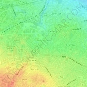
Walkinstown topographic map
Interactive map
Click on the map to display elevation.
About this map
Name: Walkinstown topographic map, elevation, terrain.
Average elevation: 49 m
Minimum elevation: 27 m
Maximum elevation: 73 m
Other topographic maps
Click on a map to view its topography, its elevation and its terrain.
Priorswood
Ireland > County Dublin > Dublin
Priorswood, Priorswood E Ward 1986, Dublin, County Dublin, Leinster, D17 XV48, Ireland
Average elevation: 42 m
Dublin
Ireland > County Dublin > Dublin
Dublin, Dún Laoghaire-Rathdown, County Dublin, Leinster, Ireland
Average elevation: 23 m
Liberty of Donore
Ireland > County Dublin > Dublin
Liberty of Donore, Kimmage C Ward 1986, Dublin, County Dublin, Leinster, Ireland
Average elevation: 27 m
Bluebell
Ireland > County Dublin > Dublin
Bluebell, Inchicore B Ward 1986, Dublin, County Dublin, Leinster, Ireland
Average elevation: 44 m
Darndale
Ireland > County Dublin > Dublin
Darndale, Priorswood C Ward 1986, Dublin, County Dublin, Leinster, Ireland
Average elevation: 35 m
Ballygall
Ireland > County Dublin > Dublin
Ballygall, Finglas East D ED, Dublin, County Dublin, Leinster, Ireland
Average elevation: 53 m
Sandymount
Ireland > County Dublin > Dublin
Sandymount, Pembroke East C ED, Dublin, County Dublin, Leinster, Ireland
Average elevation: 5 m
Santry
Ireland > County Dublin > Dublin
Santry, Whitehall C ED, Dublin, County Dublin, Leinster, Ireland
Average elevation: 54 m
Glasnevin
Ireland > County Dublin > Dublin
Glasnevin, Glasnevin A ED, Dublin, County Dublin, Leinster, D09 YN97, Ireland
Average elevation: 33 m
North Bull Island
Ireland > County Dublin > Dublin
North Bull Island, Raheny St. Assam ED, Dublin, County Dublin, Leinster, Ireland
Average elevation: 2 m
Rathgar
Ireland > County Dublin > Dublin
Rathgar, Rathfarnham A ED, Dublin, County Dublin, Leinster, Ireland
Average elevation: 40 m
Santry
Ireland > County Dublin > Dublin
Santry, Dublin, Fingal, County Dublin, Leinster, Ireland
Average elevation: 49 m
Belcamp
Ireland > County Dublin > Dublin
Belcamp, Priorswood B ED, Dublin, County Dublin, Leinster, Ireland
Average elevation: 37 m
Dublin Castle
Ireland > County Dublin > Dublin
Dublin Castle, Castle Street, Royal Exchange A ED, Dublin, County Dublin, Leinster, D02 YP97, Ireland
Average elevation: 16 m
Clonmel
Ireland > County Dublin > Dublin
Clonmel, Ballymun E ED, Dublin, County Dublin, Leinster, Ireland
Average elevation: 57 m
Rathmines
Ireland > County Dublin > Dublin
Rathmines, Rathmines West B ED, Dublin, County Dublin, Leinster, Ireland
Average elevation: 28 m
Ringsend
Ireland > County Dublin > Dublin
Ringsend, Pembroke East A Ward 1986, Dublin, County Dublin, Leinster, Ireland
Average elevation: 5 m
Terenure
Ireland > County Dublin > Dublin
Terenure, Rathfarnham A ED, Dublin, County Dublin, Leinster, D06 K767, Ireland
Average elevation: 45 m