
't Zand topographic map
Interactive map
Click on the map to display elevation.
About this map
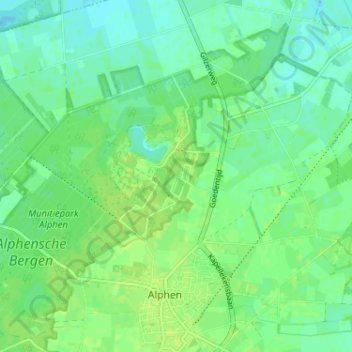
Name: 't Zand topographic map, elevation, terrain.
Average elevation: 22 m
Minimum elevation: 16 m
Maximum elevation: 27 m
Other topographic maps
Click on a map to view its topography, its elevation and its terrain.
Looneind
Nederland > Noord-Brabant > Alphen
Looneind, Alphen, Alphen-Chaam, Noord-Brabant, Nederland, 5131 RK, Nederland
Average elevation: 22 m
Recreatiepark ‘t Zand
Nederland > Noord-Brabant > Alphen > 't Zand
Recreatiepark ‘t Zand, 't Zand, Alphen, Alphen-Chaam, Noord-Brabant, Nederland
Average elevation: 22 m