Geolocate

Neff topographic map

Click on the map to display elevation.

About this map
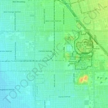
Name: Neff topographic map, elevation, terrain.

Location: Neff, Anaheim, Orange County, California, 92802, United States (33.78946 -117.95284 33.82946 -117.91284)

Average elevation: 39 m

Minimum elevation: 29 m

Maximum elevation: 58 m

Other topographic maps

Click on a map to view its topography, its elevation and its terrain.

Cars Land

United States > California > Orange County > Anaheim

Average elevation: 42 m

Gear up for your next adventure:

☕Vacuum Insulated Flasks - Keep tea or coffee hot for 12 hours on the summit
🦯Lightweight Trekking Poles - Reduce knee strain on steep Wicklow or Kerry slopes
🧤Thermal Outdoor Gloves - Windproof and waterproof gloves for winter hiking
🧗Rock Climbing Gear - Essentials for the cliffs of Moher or Gap of Dunloe
🔥Compact Camping Stoves - Fast-boil stoves for trail-side meals and coffee

As an Amazon Associate, this site earns from qualifying purchases at no extra cost to you.