Geolocate

Goch topographic map

Click on the map to display elevation.

About this map
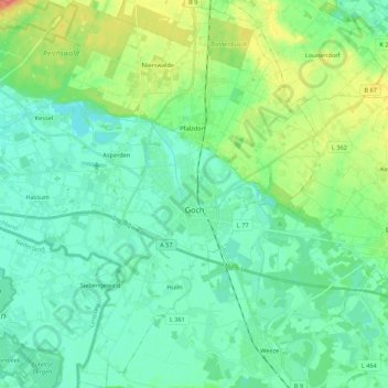
Name: Goch topographic map, elevation, terrain.

Location: Goch, Kreis Kleve, North Rhine-Westphalia, 47574, Germany (51.61380 6.02605 51.74803 6.22933)

Average elevation: 24 m

Minimum elevation: 9 m

Maximum elevation: 68 m

Other topographic maps

Click on a map to view its topography, its elevation and its terrain.

Keeken

Germany > North Rhine-Westphalia > Kreis Kleve > Cleves

Average elevation: 13 m

Rindern

Germany > North Rhine-Westphalia > Kreis Kleve > Cleves

Average elevation: 21 m

Empel

Germany > North Rhine-Westphalia > Kreis Kleve > Rees

Average elevation: 18 m

Asperden

Germany > North Rhine-Westphalia > Kreis Kleve > Goch

Average elevation: 18 m

Vorselaer

Germany > North Rhine-Westphalia > Kreis Kleve > Weeze

Average elevation: 20 m

Gear up for your next adventure:

⌚Smart Watches for Hiking - Track performance on trails
🧶Camping String Lights - Ambience and utility lighting
🔗Locking Carabiners - Secure gear to your pack or for light climbing
🧂Electrolyte Tablets - Stay hydrated during strenuous mountain climbs
📍Trail Markers & GPS - Tools to track and mark trails

As an Amazon Associate, this site earns from qualifying purchases at no extra cost to you.