
Thank you for supporting this site ❤️
Make a donation
Make a donation
Gear up for your next adventure:
As an Amazon Associate, this site earns from qualifying purchases at no extra cost to you.
Bedrock topographic map
Click on the map to display elevation.
Thank you for supporting this site ❤️
Make a donation
Make a donation
Gear up for your next adventure:
As an Amazon Associate, this site earns from qualifying purchases at no extra cost to you.
About this map
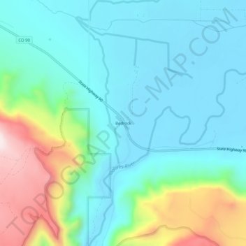
Name: Bedrock topographic map, elevation, terrain.
Location: Bedrock, Montrose County, Colorado, 81411, United States (38.29499 -108.91094 38.33499 -108.87094)
Average elevation: 1,635 m
Minimum elevation: 1,507 m
Maximum elevation: 2,027 m
Thank you for supporting this site ❤️
Make a donation
Make a donation
Gear up for your next adventure:
As an Amazon Associate, this site earns from qualifying purchases at no extra cost to you.