
Thank you for supporting this site ❤️
Make a donation
Make a donation
Gear up for your next adventure:
As an Amazon Associate, this site earns from qualifying purchases at no extra cost to you.
Valbruna topographic map
Click on the map to display elevation.
Thank you for supporting this site ❤️
Make a donation
Make a donation
Gear up for your next adventure:
As an Amazon Associate, this site earns from qualifying purchases at no extra cost to you.
About this map
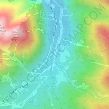
Name: Valbruna topographic map, elevation, terrain.
Location: Valbruna, Tarvisio, Udine, Friuli-Venezia Giulia, Italy (46.45761 13.48308 46.47925 13.49477)
Average elevation: 1,130 m
Minimum elevation: 840 m
Maximum elevation: 1,742 m
Thank you for supporting this site ❤️
Make a donation
Make a donation
Gear up for your next adventure:
As an Amazon Associate, this site earns from qualifying purchases at no extra cost to you.