
Thank you for supporting this site ❤️
Make a donation
Make a donation
Gear up for your next adventure:
As an Amazon Associate, this site earns from qualifying purchases at no extra cost to you.
Tafalla topographic map
Click on the map to display elevation.
Thank you for supporting this site ❤️
Make a donation
Make a donation
Gear up for your next adventure:
As an Amazon Associate, this site earns from qualifying purchases at no extra cost to you.
About this map
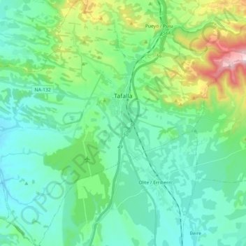
Name: Tafalla topographic map, elevation, terrain.
Location: Tafalla, Erdialdea / Zona Media, Navarre, Spain (42.44692 -1.79439 42.57916 -1.61527)
Average elevation: 453 m
Minimum elevation: 337 m
Maximum elevation: 872 m
Thank you for supporting this site ❤️
Make a donation
Make a donation
Gear up for your next adventure:
As an Amazon Associate, this site earns from qualifying purchases at no extra cost to you.