
Маньпупунёр topographic map
Interactive map
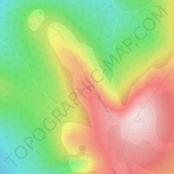
Click on the map to display elevation.
About this map
Name: Маньпупунёр topographic map, elevation, terrain.
Average elevation: 598 m
Minimum elevation: 390 m
Maximum elevation: 812 m
Other topographic maps
Click on a map to view its topography, its elevation and its terrain.
Pechora-Ilych Nature Reserve
Russia > Komi Republic > Troitsko-Pechorsky District > Якша
Pechora-Ilych Nature Reserve, Якша, сельское поселение Якша, Troitsko-Pechorsky District, Komi Republic, Northwestern Federal District, 169436, Russia
Average elevation: 157 m