
Thank you for supporting this site ❤️
Make a donation
Make a donation
Gear up for your next adventure:
As an Amazon Associate, this site earns from qualifying purchases at no extra cost to you.
Mwanza topographic map
Click on the map to display elevation.
Thank you for supporting this site ❤️
Make a donation
Make a donation
Gear up for your next adventure:
As an Amazon Associate, this site earns from qualifying purchases at no extra cost to you.
About this map
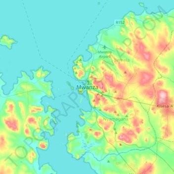
Name: Mwanza topographic map, elevation, terrain.
Location: Mwanza, Nyamagana, Mwanza, Lake Zone, 33102, Tanzania (-2.67969 32.74144 -2.35969 33.06144)
Average elevation: 1,178 m
Minimum elevation: 1,129 m
Maximum elevation: 1,346 m
Thank you for supporting this site ❤️
Make a donation
Make a donation
Gear up for your next adventure:
As an Amazon Associate, this site earns from qualifying purchases at no extra cost to you.