
Make a donation
Gear up for your next adventure:
As an Amazon Associate, this site earns from qualifying purchases at no extra cost to you.
Hochries topographic map
Click on the map to display elevation.
Make a donation
Gear up for your next adventure:
As an Amazon Associate, this site earns from qualifying purchases at no extra cost to you.
Hochries
Der Gipfel ist per Bahn von Grainbach aus zu erreichen. Vom Ort geht ein Sessellift zur Mittelstation auf 920 m Höhe. Von dort führt eine Kabinenbahn auf den Gipfel. Die Hochries ist als Rosenheimer „Hausberg“ beliebt bei Wanderern sowie insbesondere Gleitschirm- und Drachenfliegern.
Make a donation
Gear up for your next adventure:
As an Amazon Associate, this site earns from qualifying purchases at no extra cost to you.
About this map
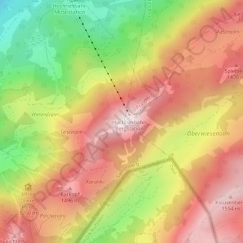
Name: Hochries topographic map, elevation, terrain.
Average elevation: 1,223 m
Minimum elevation: 787 m
Maximum elevation: 1,559 m
Make a donation
Gear up for your next adventure:
As an Amazon Associate, this site earns from qualifying purchases at no extra cost to you.