
Freiria topographic map
Interactive map
Click on the map to display elevation.
About this map
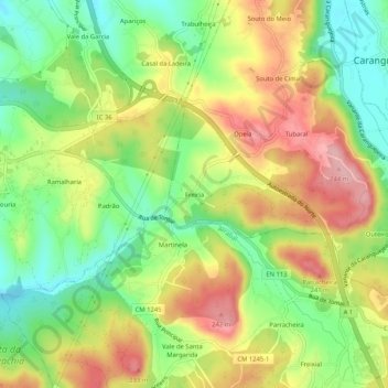
Name: Freiria topographic map, elevation, terrain.
Location: Freiria, Leiria, Caranguejeira, Leiria, 2410-021, Portugal (39.70983 -8.75398 39.74983 -8.71398)
Average elevation: 160 m
Minimum elevation: 87 m
Maximum elevation: 243 m