
Thank you for supporting this site ❤️
Make a donation
Make a donation
Gear up for your next adventure:
As an Amazon Associate, this site earns from qualifying purchases at no extra cost to you.
Germil topographic map
Click on the map to display elevation.
Thank you for supporting this site ❤️
Make a donation
Make a donation
Gear up for your next adventure:
As an Amazon Associate, this site earns from qualifying purchases at no extra cost to you.
About this map
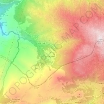
Name: Germil topographic map, elevation, terrain.
Location: Germil, Ponte da Barca, Viana do Castelo, 4840-070, Portugal (41.76392 -8.28538 41.80392 -8.24538)
Average elevation: 701 m
Minimum elevation: 179 m
Maximum elevation: 1,087 m
Thank you for supporting this site ❤️
Make a donation
Make a donation
Gear up for your next adventure:
As an Amazon Associate, this site earns from qualifying purchases at no extra cost to you.